
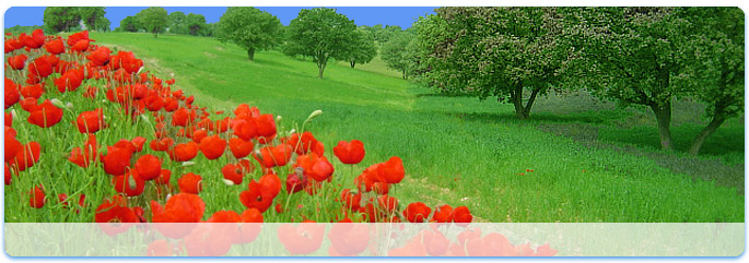
 spring
- Iran's climate
To the west, settlements in the Zagros basin experience lower temperatures, severe winters with below zero average daily temperatures and heavy snowfall. The eastern and central basins are arid, with less than 200 mm (7.9 in) of rain, and have occasional deserts. Average summer temperatures exceed 38 °C (100.4 °F). The coastal plains of the Persian Gulf and Gulf of Oman in southern Iran have mild winters, and very humid and hot summers. The annual precipitation ranges from 135 to 355 mm (5.3 to 14.0 in).
- Caspian Hyrcanian mixed forests
The Caspian Hyrcanian Mixed Forests ecoregion, in the temperate broadleaf and mixed forests biome, is an area of lush lowland and montane forests covering about 55,000 square kilometres (21,000 sq mi) near the southern shores of the Caspian Sea of Azerbaijan and Iran.
In Iran, this ecoregion includes the coast along the Caspian Sea and the northern slopes of the Alborz Mountains. It covers parts of five provinces of Iran from east to west including: North Khorasan Province, Golestan Province (entirely southern and southwestern areas as well as parts of the eastern regions of the Gorgan plain, totaling an area of 421,373 hectares (1,041,240 acres). The total wood production from these forests is estimated at 269,022 cubic metres (9,500,400 cu ft). Golestan National Park and Shastkolateh forest watershed are located in Golestan Province), Mazandaran Province (the total area of the Hyrcanian forest is estimated at 965,000 ha (2,380,000 acres). From these forests, 487,195 ha (1,203,890 acres) are used commercially, 184,000 ha (450,000 acres) are protected and the rest are regarded as forest lands or over-used forests. The total of the forest woods used in this province is estimated at 770,551 cubic metres (27,211,800 cu ft). The Kojoor, Dohezar and Sehezar forest watersheds are located in Mazandaran province), Gilan province (these forests are graded from 1 to 3 with an area of 107,894 ha (266,610 acres); 182,758 ha (451,600 acres) and 211,972 ha (523,790 acres), respectively. The commercial utilization is 184,202 m3 (6,505,000 cu ft) and the non-commercial utilization is 126,173 m3 (4,455,800 cu ft). Masooleh, Ghaleh Roodkhan and Astara forest watersheds are located in Gilan province) and Ardabil Province. At higher elevations to the south, the ecoregion grades into the Elburz Range forest steppe ecoregion.
In southeast Azerbaijan, this ecoregion includes the Lankaran Lowland and the Talysh Mountains.
The ecoregion’s climate is humid subtropical, in higher and more northerly locations, oceanic and in the mountains, humid continental with most precipitation occurring in fall, winter, and spring. The Alborz mountain range is the highest mountain range in the Middle East which captures the moisture of the Caspian Sea. Annual rainfall ranges from 900 mm (35 in) in the north to 1,600 mm (63 in) in the south, making this ecoregion much lusher than the desert, semi-desert, and steppe ecoregions on its borders.
- Flora
The natural forest vegetation is temperate deciduous broadleaved forest. 32.7 percent of volume of Hyrcanian forest is of Oriental Beech (Fagus orientalis). A main feature of the region is the lack of conifers; only relics of coniferous species are present, which include European yew (Taxus baccata), Junipers (Juniperus spp.), Mediterranean Cypress (Cupressus sempervirens var. horzontalis) and Chinese Arborvitae (Platycladus orientalis).
The Caspian Sea coastal plains were once covered by Chestnut-leaved Oak (Quercus castaneifolia), European Box (Buxus sempervirens), Black Alder (Alnus glutinosa subsp. barbata), Caucasian Alder (Alnus subcordata), White Poplar (Populus alba) and Caucasian Wingnut (Pterocarya fraxinifolia), but these forests have been almost entirely converted to urban and agricultural land. (Mosadegh, 2000; Marvie Mohadjer, 2007)
The lower slopes of Talysh and Alborz Mountains below 700 metres (2,300 ft) harbor diverse humid forests containing Chestnut-leaved Oak, European Hornbeam (Carpinus betulus), Persian Ironwood (Parrotia persica), Caucasian Zelkova (Zelkova carpinifolia), Persian Silk Tree (Albizia julibrissin), and Date-plum (Diospyros lotus) along with shrubs holly (Ilex hyrcana), Ruscus hyrcanus, Danaë racemosa, and lianas Smilax excelsa and Hedera pastuchowii (Mosadegh, 2000; Marvie Mohadjer, 2007). Persian Ironwood is endemic to the Talysh Mountains and northern Iran and nearly pure stands of the tree can be particularly dramatic, with lichen-covered branches twisting together and only dead leaves in the deep shade of the forest floor. In addition, the ironwood's yellow leaves turn a faint lilac in the fall.
At middle elevations between 700 and 1,500 m (2,297 and 4,921 ft), Oriental Beech is the dominant tree species in this cloudy zone in pure and mixed stands with other noble hardwoods such as Chestnut-leaved Oak, Caucasian Oak (Quercus macranthera), European Hornbeam (Carpinus betulus), Oriental Hornbeam (C. orientalis) and Sweet Chestnut (Castanea sativa). From its floristic composition, these beech forests are linked with European forests and with affinities to the beech forests of the Balkans. However, local conditions of aspect and edaphic factors, such as soil moisture and depth, are all of importance in determining the composition of the vegetation, which leads to the establishment of different beech subcommunities. (Mosadegh, 2000; Marvie Mohadjer, 2007)
Upper mountain and subalpine zones are characterized by Caucasian Oak, Oriental Hornbeam, shrublands and steppes. Alpine tundra and meadows occur at the highest elevations.
Other native tree species include Caspian Locust (Gleditsia caspica), Velvet Maple (Acer velutinum), Cappadocian Maple (Acer cappadocicum), European Ash (Fraxinus excelsior), Wych Elm (Ulmus glabra), Wild Cherry (Prunus avium), Wild Service Tree (Sorbus torminalis) and lime tree (Tilia dasystyla).
- Fauna
The Caspian tiger (Panthera tigris virgata) once roamed these mountains, but is now extinct. Other large mammals here are the Caucasus leopard (Panthera pardus ciscaucasica), lynx (Lynx lynx), brown bear (Ursus arctos), wild boar (Sus scrofa), wolf (Canis lupus), golden jackal (Canis aureus), jungle cat (Felis chaus), badger (Meles meles), and otter (Lutra lutra).
This ecoregion is an important resting area for birds migrating between Russia and Africa and is thus a key habitat for many bird species. Some outstanding birds that can be found here are the greylag goose (Anser anser), white-fronted goose (Anser albifrons), Little bustard (Tetrax tetrax), glossy ibis (Plegadis falcinellus), Eurasian spoonbill (Platalea leucorodia), night heron (Nycticorax nycticorax), red-breasted goose (Branta ruficollis), peregrine falcon (Falco peregrinus), Dalmatian pelican (Pelecanus crispus), buff-backed heron (Bubulcus ibis), squacco heron (Ardeola ralloides), greater flamingo (Phoenicopterus roseus), white-headed duck (Oxyura leucocephala), and Caspian snowcock (Tetraogallus caspius).
- Protected areas
The diversity and endemism of the species represented in the ecoregion make it an important area for conservation. The habitats in this ecoregion are threatened by conversion into tea, vegetable, fruit, and vine plantations, unsustainable forestry and poaching.
The existing protected areas in Azerbaijan include:
Gizil-Agach State Reserve – 88.4 square kilometres (34.1 sq mi)
Hirkan National Park - 427.97 square kilometres (165.24 sq mi)
Zuvand National Park - 15 square kilometres (5.8 sq mi)
The existing protected areas in Iran include:
Golestan National Park
Jahan Nama Protected Area
Central Alborz Protected Area
Lisar Protected Area
Siah Keshim Protected Area
Dodangeh Wildlife Refuge
Miankaleh Wildlife Refuge
Selkeh Wildlife Refuge
Dashtenaz Wildlife Refuge
Iran’s Deserts
- Dasht-e Lut
Dasht-e Lut, also spelled Dasht-i-Lut, is a large salt desert in southeastern Iran and is the world's 25th largest desert.
Iran is climatically part of the Afro-Asian belt of deserts that stretch from the Cape Verde islands off West Africa all the way to Mongolia near Beijing, China. The patchy, elongated, light-colored feature in the foreground (parallel to the mountain range) is the northernmost of the Dasht dry lakes that stretch southward 300 kilometers (186 miles). In near-tropical deserts, elevated areas capture most precipitation. As a result, the Dasht-e Lut is generally considered to be an abiotic zone.
Iran's geography consists of a plateau surrounded by mountains and divided into drainage basins. Dasht-e Lut is one of the largest of these desert basins, 480 kilometers (300 miles) long and 320 kilometers (200 miles) wide, and is considered to be one of the driest places on Earth.
Area of the desert is about 51,800 square kilometers (20,000 mi²).The other large basin is the Dasht-e Kavir. During the spring wet season, water briefly flows down from the Kerman mountains, but it soon dries up, leaving behind only rocks, sand, and salt.
The eastern part of Dasht-e Lut is a low plateau covered with salt flats. In contrast, the center has been sculpted by the wind into a series of parallel ridges and furrows, extending over 150 km (90 miles) and reaching 75 m (250 ft) in height. This area is also riddled with ravines and sinkholes. The southeast is a vast expanse of sand, like a Saharan erg, with dunes 300 m (1000 ft) high, among the tallest in the world.
Hottest land surface
Measurements of MODIS (Moderate-Resolution Imaging Spectroradiometer) installed on NASA's satellite "Aqua" from 2003 - 2005 testify that the hottest land surface on Earth is located in Dasht-e Lut and land surface temperatures reach here 70.7 degrees C (159 degrees F). Precision of measurements is 0.5 - 1 degrees K.
The hottest part of Dasht-e Lut is Gandom Beryan - approximately 480 km² large plateau covered with dark lava. According to local legend this name (in translation from Persian - "Toasted wheat") originates from an accident where load of wheat left in the desert was scorched by the heat in a few days time.